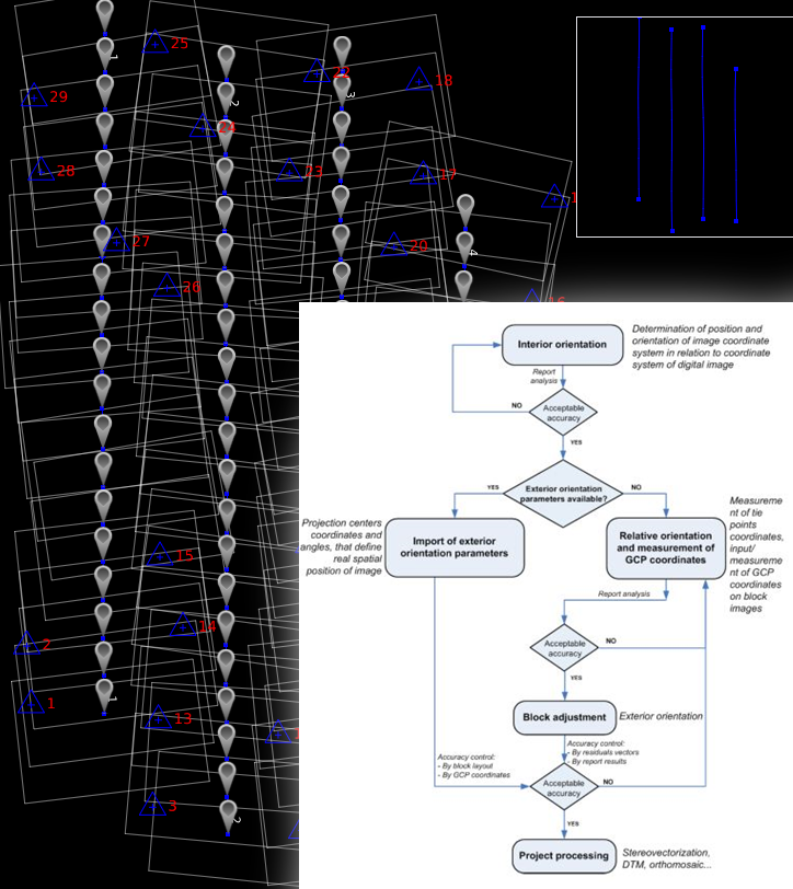
Aerial Triangulation/Aero Triangulation
Basically, Aerial triangulation represents the process for determining the correct position and orientation of each image in a series of aerial images so they can be compiled into a map.
Aerial triangulation is the term applied to the process of determining x, y and z Ground coordinate of individual points on measurements from the photograph.
The principal application is in extending Ground control through strip or block of photo for use in subsequent photogrammetric operation.
The quality control of aerial triangulation is done by assuring the working steps completeness and the final results consistency:
- the relative orientation is satisfactory for all images in a block
- the residuals of AT compensation are smaller than 1.2 * pixel image size
- RMS values are less than 0.8 * pixel image size
- RMS (x, y) and RMS (z) for GCPs (also check GCPs) are smaller than the final GSD of the block