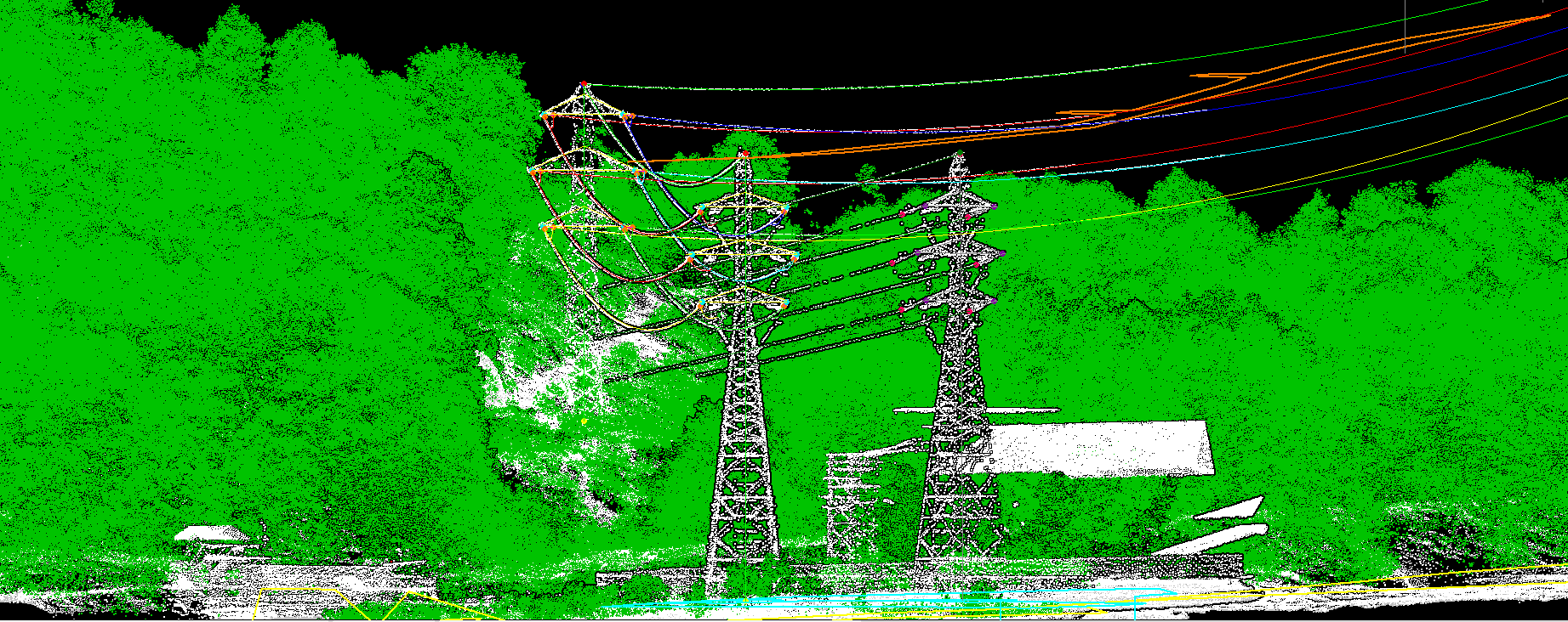
Light Detection and Ranging (LIDAR) can be used for collecting spatial data of power (transmission) lines providing more accurate geometric information of the power lines and vegetation/object near power electric network.
The optimal combination of LiDAR data and fieldwork allows providing ultimate and utility mapping services, as well as decreasing drastically the costs of traditional electrical grid design, network maintenance and inspection services. By designing the electrical network in 2D and 3D from LIDAR and Imagery (both for transmission lines and distribution lines), we can able to provide to our global clients accurate 2D and 3D power line models at a very efficient cost.
MakeInGIS is very much capable and able to perform specific analysis using different safety parameters for each voltage, span, pole or tower by our 100% customizable software. The outcomes of these analysis become a vital information for utilities, as it helps them to manage and plan the maintenance of their network at different levels and prioritize their next steps.
With our expertise in LiDAR data processing and software development, we have created our own set of internal tools. These tools and algorithms are 100% customizable for each project, bringing us the possibility of adapting our results and workflow to each client’s requirement and consequently to provide high accurate products and very competitive costs.
Through our extensive experience & with our QA tool, we provide you better and faster results for 3D network design, vegetation management, clearance distances or PLS-CADD modeling among others.- Utility mapping & inventories (crossings, buildings, assets)
- 2D & 3D power line network design
- 3D Planimetry features
- PLS-CADD modeling
- Ground
- Vegetation
- Conductors, Shield Wire, Towers, Poles and Substation
- Conductor Attachment at Insulators
- Stringed Wires
- Insulator Attachment at Tower
- Tower Top & Bottom
- Railway line
- All Natural and Manmade features
- 3D vectors of all visible features
- Other Features (Buildings, Cars, Trains, Livestock, Woodpiles, Sign boards, Traffic signals, Street lights, Small poles etc.